Noticings

For a while Tom Armitage and I have been kicking around the idea of a game called Noticings. Recently we managed to find the time to build a simple version of it, and a few of our friends have been playing it for a few weeks. It seems to be going OK, so yesterday I took the password off and opened it to the world.

From our about page:

Cities are wonderful places, and everybody finds different things in them. Some of us like to take pictures of interesting, unusual, or beautiful things we see, but many of use are moving so fast through the urban landscape we don't take in the things around us.

Noticings is a game you play by going a bit slower, and having a look around you. It doesn't require you change your behaviour significantly, or interrupt your routine: you just take photographs of things that you think are interesting, or things you see. You'll get points for just noticing things, and you might get bonuses for interesting coincidences.

If you spot something interesting, take a photo of it and upload it to Flickr, tagged with 'noticings' and some geodata. Each day is a turn, and photos from the day get pulled in at 3pm GMT the following day, giving you time to upload them and tag them properly.

We're starting very simple. There are two rules:

Slowly, as the game evolves we'll add new, more exciting rules and tweak the old ones. Perhaps extra points for venturing out at lunchtime every day for a week, or for spotting things along lines of latitude or longitude. Who knows? It's part art, part psychogeography, part city discovery engine. You can keep up with the changes on the blog.

We'd love it if you gave it a go, and even more if you let us know your thoughts (email is probably best).

Update: Tom has jotted down some his thoughts, expressing the goal much better than I.
London Bus iPhone and iPod Touch Application

London Bus iPhone and iPod Touch Application

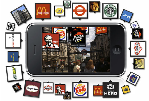
All of this augmented reality stuff looks incredibly dated before its even launched. There must be something more interesting that can be done with the Little Box of Powerful Sensing that doesn't involve stabbing your fingers at Big Logos floating across smudged glass screens. Something more like the Whispers of Angels.

Just a hint, a gentle nudge. Like a cheat in a videogame. Technology finessed to the point that you could easily convince yourself that if you were smarter, a more capable person, you wouldn’t need it.

Caen Hill

Caen Hill

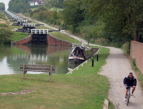
A 16 lock canal ascent on the Kennet and Avon canal in Wiltshire. For the extreme canal enthusiast.

From a great selection of quirky places to cycle in Britain.

A world and a life in which you are always the centre of the map

P1000011

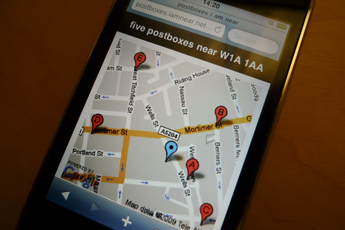
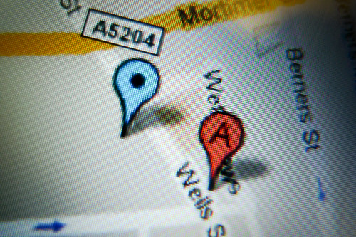
iamnear is still chugging along. Yesterday I added postboxes, courtesy of Matthew Somerville's postbox locator service, and made it work with Fire Eagle again. It's not very exciting, but it's useful.

On my todo list still is an evil twin of iamnear, designed to be difficult and disorientating in use, but rewarding in unexpected ways should you persevere with it. As Kevin Slavin recently said in his talk at the BLDGBLOG book launch: "a world and a life in which you are always the centre of the map… fuck that".

P1000012

Morse-it

Morse-it is a really well put together iPhone application for encoding, decoding and learning Morse code. There's a little video showing it in action - skip to a minute or so in to see two iPhones side-by-side, one transmitting and one receiving. And then buy a copy, hold it up to your speakers and watch it do the same with this video. Clever.

It's worth a shot

I'm pretty sure that with both the Haynes Apollo 11 Owner's Workshop Manual and the Command Module & Lunar Module code, one could have a fairly solid attempt at a moon landing.

Mapping the mobile Social Atlas

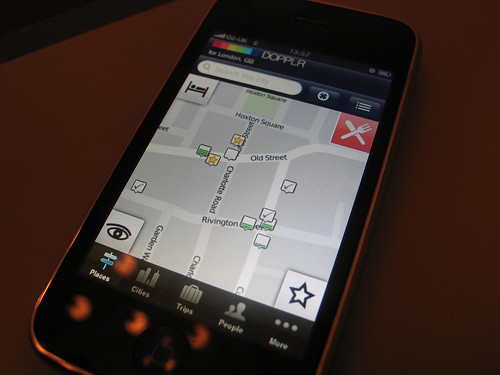
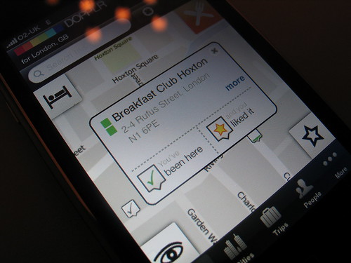
Snatching a moment at the back of Sketching in Hardware, I wanted to talk about the Dopplr iPhone app, and a few of the technical details and design decisions. In this post I'm going to focus on the map interface, as that's the core of application. I'll touch on other thoughts in a separate post later on.

the social atlas

One of the first things people notice upon booting up the app is that we're not using Google Maps. Dopplr concentrates on city travel, and the majority of the most travelled to cities now have superb OpenStreetMap coverage. Using OSM gave us the flexibility to design our own custom map, reflecting how people use the Social Atlas: at human scale, often on foot, bicycle or public transport.

Matt Jones was inspired by Kevin Lynch's The Image of the City to develop a style specific to city size, human scale navigation. Matt wrote:

Lynch contended that we make legible mental maps of the city with 5 types of object: paths, edges, districts, nodes, and landmarks.

I’m trying to make a style that emphasises these, and eschews the ’satnav’ style car-oriented mapping. It must be noted that this is a style that works most effectively at city-scale zoom levels, which it’s intended for. It looks pretty useless at country-scale.

This was made possible because of Cloudmade's superb Style Editor, a simple interface for themeing and tweaking OSM maps in the browser. In days gone by, we'd have had to spool up our own Mapnik installation, translate Matt's thoughts and designs into code, and dealt with keeping the tiles up to date. We're more than happy to let Cloudmade deal with that - they're the experts.

To display all these beautiful tiles, we're using route-me. Consider how young the project is, it's in very good shape. We're using a revision just before 0.5, and it's proved stable and quick. OK, it's not quite as smooth as the Google Maps library, and there a few niggles, but development is ongoing and Hal Mueller and the rest of the contributors are very responsive and friendly. I recommend checking it out.

I'll touch on our data fetching and caching strategy for placemarks in another post. I think it's going to need diagrams.

the social atlas

I winged about homogenous locative services in a previous, very grumpy post. I hope that we've shown a little bit of what's possible with easily accessible libraries, tools and open data.

Of course, it's not perfect, so do get in touch with the Dopplr team with your thoughts - this is the first foray into the mobile Social Atlas and your feedback is greatly appreciated.

Dopplr iPhone application

The Dopplr iPhone application launched yesterday. I was lucky enough to be the lead developer on it, so I'm slightly biased when I say you should go and give it a whirl - it's free and doesn't require a Dopplr account.

More to come when I get a moment.

Computational Wood

I'm at Sketching in Hardware for the next few days - a mini-conference on physical computing and the stuff floating nearby.

Matt Cottam just showed us this video about computational wood - wood grown with conductive ink. It's mad and bonkers and genius, and a lot of fun.

Prowl

Prowl is an iPhone app that forwards Growl notifications from your Mac to your iPhone. That's a good idea in it's own right. But then there's a little note at the bottom of the FAQ that mentions that there's a little Perl script which allows you to push any notifications to it. So it becomes a generic push notification system for anything that you can connect to it. Like Twitter direct messages, or new comments on your blog, or well... anything. And you could rewrite that Perl script in your language of choice. It's just an HTTP GET with Basic Auth. And that makes it pretty awesome.